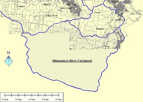
The Minnamurra River catchment area is approximately 100km2, from the Illawarra escarpment in the west to the Tasman Sea in the east. The majority of this catchment is contained within the Kiama Local Government Area, with some small areas of rural land within the Shellharbour Local Government Area. Land use within the catchment includes escarpment, bushland, rural and low/medium density residential areas. The terrain falls sharply off an escarpment with very steep upper slopes broadening out to a large and relatively flat floodplain.
| Programme schedule | Status |
| Data collection | Nothing allocated for this study area |